1
$\begingroup$

I have been searching for historical structures in the province of Van, Turkey, by examining the publicly available satellite imagery like Bing Maps. There is a historic bridge near Kaçit, Çatak. Its name is Zeril Bridge. I tried to figure out the places which are connected by the bridge. The two sides of the stream seem to be very steep and it seems to me that the bridge is situated in a strange location.

From the viewpoint of civil engineering, if you build this bridge today, what would your purpose for locating the bridge at that point be?

Coordinates of the Zeril Bridge: 37.915422 , 42.984053
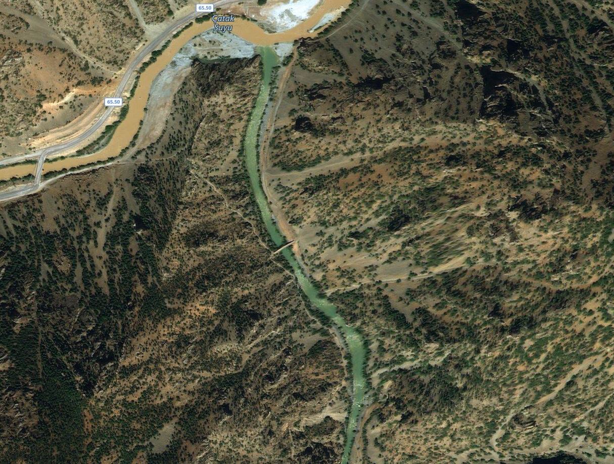
enter image description here

$\endgroup$
2
  • $\begingroup$ access to a mine entrance or somesuch... Of course it could be that there was a bridge before and it had to be replaced... $\endgroup$
    – Solar Mike
    Commented Nov 7, 2018 at 21:25
  • $\begingroup$ It's from bank width and access to the valley that the road goes to on the south west. $\endgroup$ Commented Nov 10, 2018 at 7:29

2 Answers 2

3
$\begingroup$

The location makes sense from a civil engineering perspective. The bridge has to span the river channel without being washed away during flooding events. A narrow, steep canyon works well for this because the bridge can be built high enough over the water without it having to be too long. The height gives it protection from floods, the steepness of the canyon walls keeps the span as short as possible.

Additionally, the steepness of the canyon walls gives an indication of the strength of the supporting bedrock for the abutments. The steeper the canyon sides, the more an indication of strong, hard rock. If the side slopes were flatter, this would indicate looser, more erodible soils under the ends of the bridge (the abutments). Obviously, stronger, harder rock is superior to easily eroded soils for the purposes of holding up the ends of the bridge.

As long as the bridge is built during low water times of the year, access to the site isn't too difficult. The bridge is close enough to the main river channel to be convenient enough for travelers while still taking advantage of the favorable characteristics listed above.

$\endgroup$
0
$\begingroup$

It could be used for cattle access to grazing meadows.

Or may be they where moving some kind of top soil for farming, or gypsum extraction, or mining as has been mentioned.

Or a mix of these and some illegal activities such as contraband trafficking with mules.

$\endgroup$

Your Answer

By clicking “Post Your Answer”, you agree to our terms of service and acknowledge you have read our privacy policy.

Not the answer you're looking for? Browse other questions tagged or ask your own question.